History
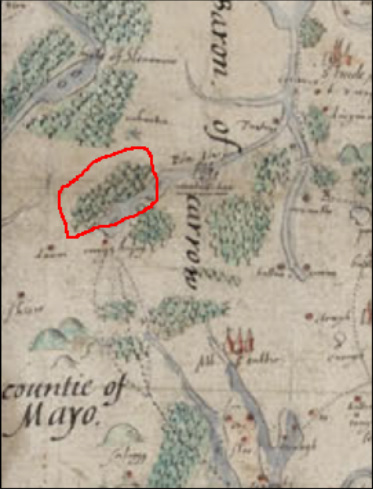
From Brown's map of Connaught (1591)
William Bald’s 1830 map of Mayo (right), from surveys done between 1809 and 1816, clearly shows Raheens as tree-covered. The ironworks themselves are drawn as well, just south-west of the woods, and labeled as ‘mills’(circled in red). For more history on Raheens Estate, click here More history of the woodland itself can be found here |
The landscape of Mayo has undergone substantial changes since the sixteenth century. Roads and towns have been built, and water courses have been altered. Significantly, the extensive woodlands once present here have become much smaller, or have disappeared altogether. John Brown’s 1591 map of Connaught clearly illustrates large areas of woods, including the land to the north of Islandeady Lough. Raheens is but a remaining fragment of this once much larger forest. Within a landscape such as the original woodland, wolves still roamed, and ‘rebels’ could last long, “dispersed in the thicks...lurking scattered like wolves or foxes, fitter to hunt with dogs than to find with men”. It is little wonder that Ireland’s woodlands were quickly put to other uses.
To the newly planted settlers, the woods may have represented danger, but they also had the potential to generate profit. Although timber was valuable for building ships and houses, a more dramatic impact on Ireland’s forests was made by the felling of trees for tanning, coopering, and iron smelting. Over 150 ironworks were operating across Ireland in the mid-seventeenth century. One was of these was at Raheens. 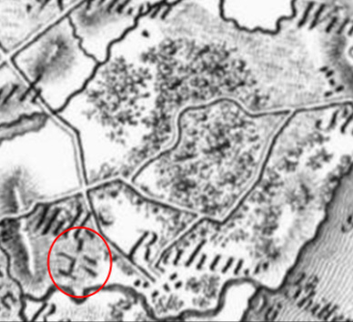
From Bald's Map of Mayo (1830)--'mills', to SW of woods, are circled
|
